Spatial Operations
Introduction
This is the root page of the user documentation for the uDig Spatial Operations extensions. Axios is providing under the Spatial Operations and Editing Tools project promoted by the Diputación Foral de Gipuzkoa, Departamento de Movilidad y Ordenación del Territorio.
These extensions comprise a set of Spatial Operations, where each of them work over the features of one or more input layers and generally populate a new one with the features resulting of applying the specific Spatial Operation.
| To enable the Spatial Operations view, go to Window ‣ Show View ‣ Other as shown in Figure 1. | The Show View dialog will pop up, then select the Spatial Operations item from the tree view as shown in Figure 2 and press OK |
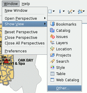
|
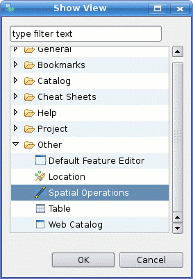
|
| Figure 1 Open others views | Figure 2 Open the Spatial Operations View |
Once you told uDig to open the Spatial Operations View, it’ll be shown as in Figure 3.
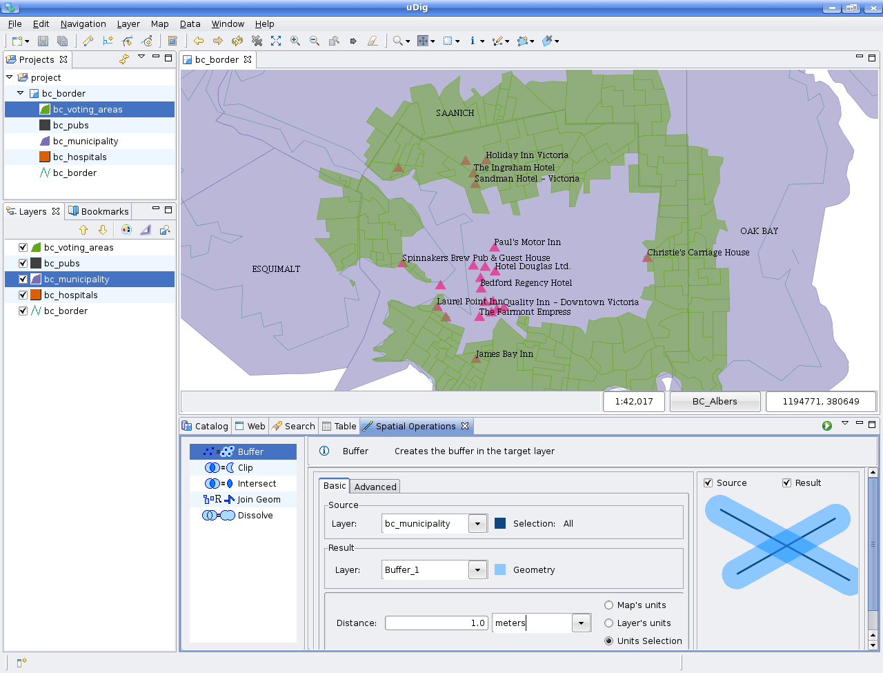
Figure 3 Spatial Operations View
Tip
Remember Views in uDig, as in most RCP based applications are very flexible. So if the standard layout does not seem appropriate for you, try changing its position by dragging the tab title, setting it as a Fast View so its only shown when needed, or set is as a Detached view so it behaves like a dialog.
Spatial Operations
Check the links bellow for specific user documentation for each of the available extensions.
- Buffer Operation — Computes a buffer area around the selected geometries.
- Clip Operation — Computes the geometric difference between two Layers.
- Dissolve Operation — Creates a new layer containing the Features grouped and merged by the selected Property.
- Fill Operation — Creates a new features using the boundary of polygons and the provided LineStrings
- Hole Cut Operation — Makes a hole inside a polygon feature using a lineString feature
- Intersect Operation — Computes the geometric intersection between two layers.
- Polygon to Line Operation — Transform a polygon layer into a LineString layer
- Spatial Join Operation — Creates a new layer containing the features from the second layer that match the indicated spatial relation.
- Split Operation — Split a polygon layer using a LineString layer